Sponsored by Esri
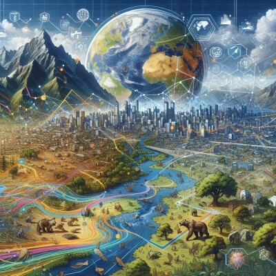
At the start of his Product Preview presentation for Esri at Geo Week 2025 in February, Esri international sales manager for reality mapping, Arkadiusz Szadkowski talked about the evolution of GIS and its path toward supporting large-scale digital twins. He noted to the crowd that humans interpret the world with two eyes, which allows us to view the world in three dimensions, and how technology is now allowing us to do the same digitally. GIS tools have always had the ability to consume multiple layers of data in an easily digestible way, and now we are starting to see imagery coming in from a variety of sensors being used to create 3D meshes tied to geographic locations.. The result is a professional community now actively seeking large-scale digital twins created using imagery from multiple sensors with the geographic backbone provided by GIS – an area in which Esri is leading the way – for visualization, simulation, and more.
Recently, Geo Week News spoke with Beau Legeer, Esri’s director of imagery and remote sensing, and Micah Callough, the company’s technical director of AEC, about the development of 3D GIS and how it is being used by the AEC industry, among others. Callough noted that, while this type of tool has been starting to mature over the last few years, it’s been around in some form for some time.
“In the early 2000s, we were doing some level of rudimentary 2.5-3D, largely for geology – things like subsurfaces, soils, sticks point down into the ground,” he said. “I worked for site geotechnical services, so my entire job was underground, and I used to use GIS for a lot of that mapping and development - 3D was a big part of it.”
That said, he described that period of it being more of a “nice-to-have,” and he didn’t really see it take hold to much of a degree in AEC until about a decade later when BIM started to become more commonplace in the industry, making 3D more front-of-mind. Now, technology is evolving to the point where imagery from various sensors – be it satellites, crewed aircraft, drones, or terrestrial-based – can be used to create 3D scenes for GIS. Leeger said Esri has been trying to push their customers more toward 3D GIS where it makes sense, and that his imagery team helps provide many of the components for the digital twins that the end users are ultimately creating.
In thinking about that imagery, as alluded to above, Legeer explained, in reference to the various sensors that are used to collect the imagery, that "we're dealing with it all."
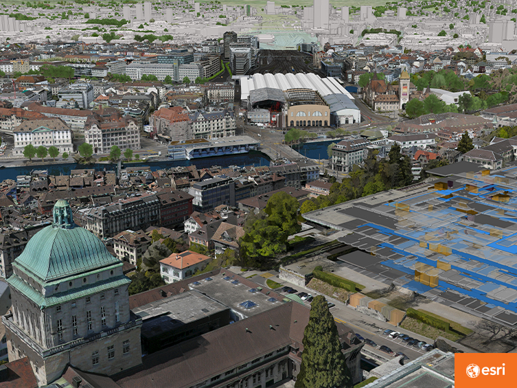
This combination of multiple sensors is crucial for these digital twins to provide the maximum amount of value. Consider that many of Esri’s customers don’t just need imagery for a very specific project area, but rather require the larger context of the surrounding area, like a city, county, or even an entire nation. That mean, they are relying on satellite imagery from Maxar and public sources and aerial imagery from crewed aircraft to capture those larger areas. Then, to hone in more on the specific areas of interest for a particular project, they will collect their own imagery with terrestrial scanners and, increasingly, drones.
“If I could mark one trend that has exploded in the last six years that I’ve been at Esri, it has been drones,” Legeer said.
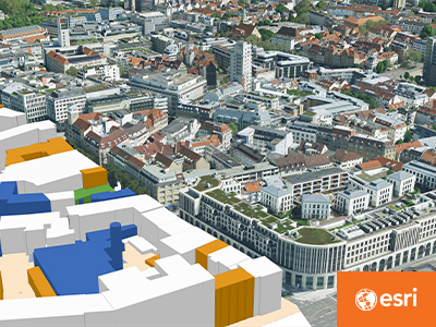
Getting into the nuts and bolts of how creating these digital twins generally works for the end user, Legeer explained that most customers are going to start with the imagery base map provided by Esri using the aforementioned satellite data. From there, customers will then bring in their own imagery data from all of the other various sensors mentioned, a process that can be as simple as just dropping in a file that is then integrated into the larger GIS dataset. Legeer also noted a new offering coming from Esri in which they will be partnering with a data collector to allow users to search and discover this kind of content directly within ArcGIS.
All of this is to say, between the content provided by Esri and users’ data, the technology is there to utilize 3D in these GIS workflows - it’s just a matter of convincing the end user that this is a worthy strategy. Certainly, it’s not a switch that comes without any barriers. Acquiring the 3D content needed to put together the entire digital twin is not without cost or even education. It’s a new paradigm, as Legeer points out, and that takes adjustment. However, he points out that when customers do overcome the initial barriers or challenges to building 3D GIS projects, “the feedback we get is overwhelmingly positive.”
The use cases run the gamut, too. With Callough, we talked a lot about how AEC firms are utilizing 3D GIS for their work. This is, of course, an industry with a reputation of pushing back against this kind of evolution, but he said that if these firms or project owners start with identifying the business driver to making the switch – rather than doing so for the sake of doing it – the value is there.
In terms of the specific adopters in the AEC industry to this point, Callough pointed to larger-scale facilities and infrastructure projects as the current use cases of 3D GIS, like airports and ports. One of the most important examples of the value that can come out of these digital twin-based workflows is providing the context of the surrounding area without having to physically travel to the location. It can be difficult to really get that context digitally, but the combination of high-quality imagery and geographic information helps to bridge that gap. Callough compares this process to that of someone preparing for travel to a new area.
“When you look at a map of how to get to a new area in a community, you might flip around on the 2D map for a while to figure out where things are and get yourself oriented,” he said. “And then you might be like, I’m going to click it up and look at the street view or the 3D view to get a real sense for where I’m at. You had a question that required a three-dimensional answer or an understanding of three dimensions in order to understand it yourself. I think that’s where Esri differentiates itself. We do both the 3D and the 2D, and we fuse those things together pretty regularly.”
Beyond the AEC industry, Legeer pointed to a few other industries who are deriving value from adopting these 3D GIS workflows, including national government and oil & gas customers. For the latter, he noted, “They want their GIS to manage the assets, whether or not they're visible from the outside or the inside. And not just a dot on a map, but the actual asset itself. And so those customers are like, We've got to go to 3D. We can handle it. We want to do this.”
Although 3D GIS has been around for decades in some form, as noted above, the workflows are really starting to come into their own in recent years, and in many ways, the evolution is just getting started. The technology now exists to both collect the content needed and integrate it all together into a usable format. With continued development around artificial intelligence, too, there’s no telling where this technology will go. Today, digital twins are enabling better visualization, analysis, and simulation than ever before for early adopters, and those who don’t adjust their paradigms sooner than later are in danger of being left behind.
“For someone who’s been in the industry as long as I have,” Leeger said, “[these capabilities] were all image science-based, reserved for the image scientist, which limited our industry. Now, it’s really coming down to these models and workflows that broaden the applicability and broaden the user base. We’re really excited about that.”
Learn More About Esri’s Imagery Capabilities Here